Aquifer Breaches
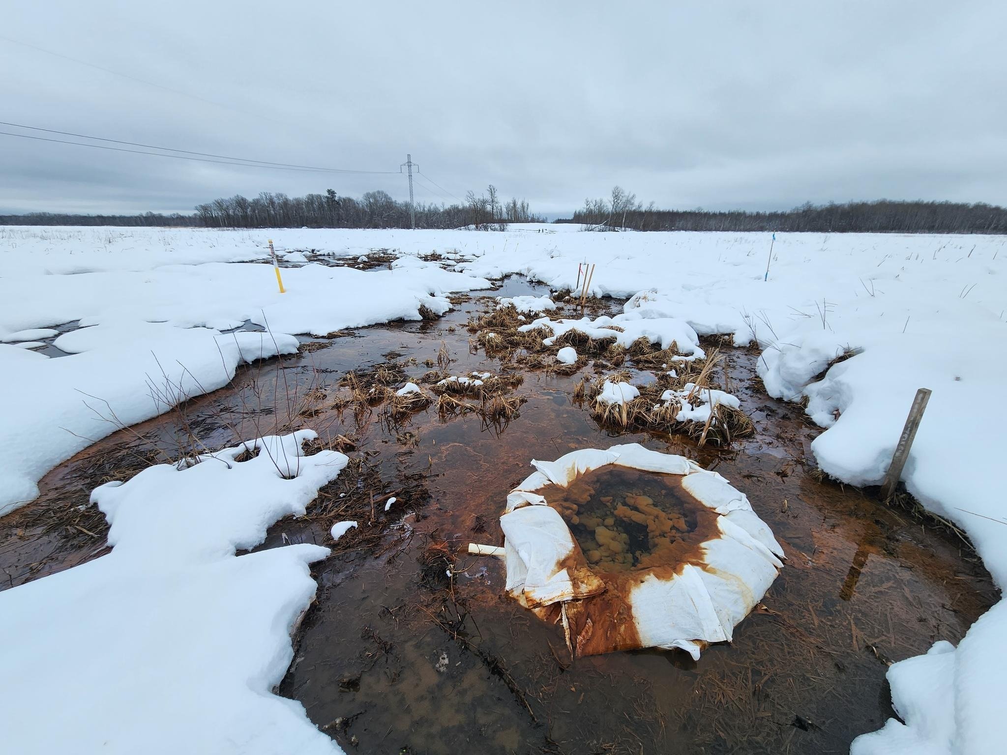
Enbridge punctured confined aquifers all along the pipeline route, unnaturally releasing thousands of gallons of groundwater to the surface. Aquifer breaches can also dry up natural springs and wells.
As this water erupts from aquifers, it alters the temperature and chemistry of surface water bodies and wetlands. This process can raise sulfate levels that could threaten key species like manoomin and permanently change the ecosystems.
State regulatory agencies have publicly identified some of the aquifer breaches Enbridge caused, but the Waadookawaad Amikwag team has identified and are monitoring about 40 possible sites of disturbed ground water. The state has yet to report certain breaches, like Walker Brook, to the public. One reason might be because it is not an artesian aquifer breach, but an unconfined, or surficial, aquifer breach. A confined aquifer is an underground layer of water trapped underneath impermeable layers of rock or clay. Confined aquifers are important because the impermeable layers above and below them create pressure, allowing the aquifer to store and release water under natural pressure, making them valuable sources of groundwater for human use and environmental ecosystems. Unconfined aquifers are open at the surface of the ground, rising and falling naturally with no pressure component, with groundwater being directly recharged, typically by rainfall or snow melt.
Enbridge’s self reporting on these disruptions has been abysmal. They failed to notify the state of major breaches as in Clearbrook, Minnesota, which resulted in criminal charges including a $1000 fine (the maximum allowed). The court ruled with a Continuance to Dismiss, based on Enbridge remaining “law abiding and of good behavior,” with the court arguing that Enbridge could not not “knowingly engage in conduct that would violate” MN Statute 103G.141.
In addition, Minnesota rules (6135.110 Standards for Route Design) specifically require avoiding routes that include steep slopes and wetlands. Much of the damages Waadookawaad Amikwag had documented are in these kinds of places… places we never should have permitted pipeline construction.
Waadookawaad Amikwag continues to push for additional criminal charges and opposes any dismissal of the criminal actions Enbridge has taken in the construction and operation of their mainline pipeline system.


Although the state has only publicly acknowledged four major aquifer breaches, Waadookawaad Amikwag has independently identified and monitors 45 sites of likely upwelling water.
The Proper Tools Make all the Difference
Thermal imaging is a spectacular tool for revealing breaches of deep groundwater which stays between 45° and 50° Fahrenheit year-round. When a confined aquifer is punctured it can cause the water to erupt to the surface of the earth, sometimes explosively. During the deep cold of winter or peak heat of summer, that upwelling water starkly contrasts the temperature of surrounding surface water and land which is much warmer or colder, depending on the season.
In November 2021, a group of organizations commissioned a fixed-wing plane equipped with a high resolution thermal imaging camera to fly over the entire Line 3/93 pipeline corridor. They captured photos of the temperature of the land and water all along the route with a sensitivity of 0.3°C in 0.25 meters. In collaboration with that group, our scientists reviewed the images for “thermal indicators,” or places where the water was unnaturally warm at the surface. This allowed them to identify dozens of places with significant thermal anomalies revealing groundwater bubbling up where it shouldn’t be. The indication was the possibility that aquifers had been breached at these locations.
The initial high-resolution thermal imaging flyover data provided our team with 45 suspect locations to investigate. Ongoing thermal imaging by our drone pilots, along with ground-truthing visits by our field team, have allowed us to verify aquifer breaches and other damages at multiple sites. Our team has been able to provide the responsible state regulatory agencies and authorities with extensive data about the breach sites they know about. And, in some cases, our team has notified the state of breaches that Enbridge had not reported and of which they were unaware.

Enbridge violated permits and kept information from the state

The first aquifer breach caused by Line 3/93 construction, near Clearbrook, Minnesota, would not be revealed to the public for over six months. Enbridge was digging a trench just outside their tank facility when, in January 2021, they dug deeper than their permit allowed. Their low-risk permit allowed them to dig up to ten feet down into the earth. Instead, the company dug deeper, to eighteen feet, and then they installed metal sheet pile retainer walls much deeper.
Although independent environmental monitors noticed the upwelling groundwater right away, and reported it on weekly reports, nothing unusual was brought to the attention of the state regulators. It wasn’t until June of 2021 that the Minnesota Department of Natural Resources (DNR) became aware of the aquifer breach, via a lunch chat with an envrionmental monitor, and began an investigation. The DNR and Minnesota Pollution Control Agency (MPCA) eventually informed the public and, almost a year later, fined Enbridge for the construction damages at this site. Minnesota’s Attorney General also filed criminal charges against Enbridge, on behalf of the county, for the Clearbrook breach and their failure to report it.
Eventually, the DNR released information about two other aquifer breaches they had been investigating, at the LaSalle Creek in Hubbard County and just outside the Fond du Lac reservation in Carlton County.
Overall, the state investigation and response has been inadequate and harmful. The project’s Independent Environmental Monitors were hardly independent, with many of them being previous Enbridge employees. By failing to utilize monitoring tools such as thermal imaging technology, state regulators have limited their own ability to understand groundwater disruptions caused by the project. The state continues to defer to Enbridge's characterization of construction impacts, rather than listen to the Minnesotans and Tribal volunteers who are monitoring the land.
Case study: Moose Lake
Moose Lake is a small manoomin lake in Aitkin County, Minnesota.
In the summer of 2022, our field team made their first visit to Moose Lake. The original flyover had shown substantial thermal indicators at the site and when our team arrived it was easy to verify. Obvious pools of upwelling water lined the corridor where sheet piling was installed. Over the course of the next year, our field volunteers visited multiple times, each time finding more and/or different types of damage. Ongoing overhead thermal drone analysis kept us informed of the changes through time, as Enbridge continued to monitor this place, adding new wells to measure water levels, and occasionally making larger changes that required heavy equipment, further compacting the land and bringing additional harm.
With the help of Healing Minnesota Stories in late July 2023, we compelled the public admission of this fourth aquifer breach by Enbridge and Minnesota state regulatory agencies. Upon acknowledgement of this fourth breach, DNR potentially underestimated the upwelling groundwater flow caused by the two-year old construction damage. While Enbridge was reported to be “providing a corrective action plan for this location as requested,” behind closed doors, the DNR was telling Waadookawaad Amikwag there were no plans for any near-term remediation work.